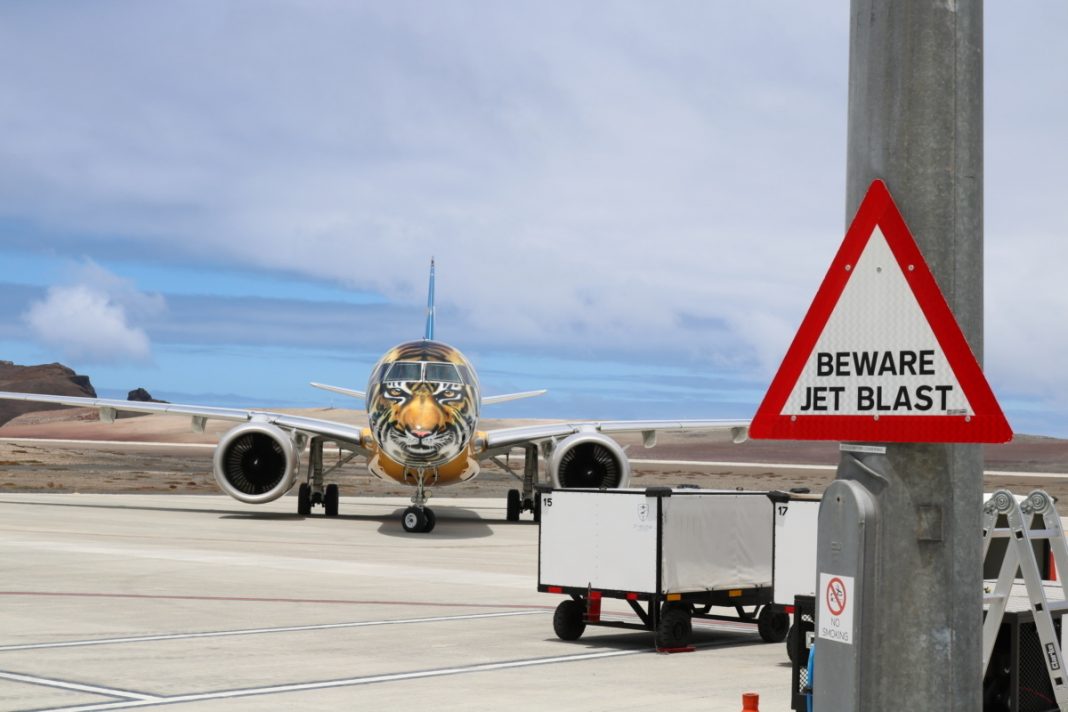
Saint Helena Airport garnished a reputation as a dangerous place to land. Somewhat unfairly, it was labeled as having a windshear problem, which actually turned out to be mainly turbulence. Today, aircraft of all shapes and sizes are able to make safe landings at the airport, thanks in part to the huge amounts of data being gathered and analyzed by the airport.

A dangerous airport?
If you listened to the hype, you’d think Saint Helena Airport was a dangerous place to fly. But, despite what the tabloids would have you believe, the airport has welcomed hundreds of flights to date, including the large Boeing 757 from Titan Airways last month. In fact, Titan has just been confirmed this week to be bringing the 757 back in September for another charter to the UK.
Airport CEO Gwyneth Howell explained why the airport had a reputation for tricky landings, telling us,
“We’ve got a famous rock called the King and Queen, which is right on the eastern part of the threshold runway two zero. That actually creates the turbulence … the turbulence then causes a vortex on final approach.”
It was this turbulence that caught out the pilots of the Comair 737 back in 2016, causing the infamous wobble that got the airport its reputation for tricky landings. But for the operators of Saint Helena Airport, giving up was not an option.
Stay informed: Sign up for our daily aviation news digest.

At one point, there was even talk about lopping the top off the King and Queen to prevent turbulence. That was not only going to be a bit expensive, but it might even make the situation worse – what you lose in turbulence you may gain in higher wind speeds that are now unchecked by terrain. Instead, the airport relies on something that is fundamental to so many aspects of aviation – data. Here’s how data is helping every flight land at Saint Helena with confidence.
Gathering data with every landing
Following the Comair wobble, Saint Helena Government initiated an intense period of data gathering and modeling to better understand the effect of the terrain on the wind.
Computer and physical models were developed to try to calculate the expected turbulence based on different wind speeds, directions and intensities. This theoretical data was then combined with real-life data and wind analysis to develop predictive weather models; these continue to develop an ever-evolving database of expected weather conditions.

While much of the attention on Saint Helena is focused on the scheduled and charter operations, the airport welcomes far more variety and frequency of aircraft. From business jets to medevac flights and even the E2 from Embraer, Saint Helena makes the most of each new arrival to gather more information on the conditions that aircraft experiences. Gwyneth explained,
” With all the operators we’ve had, we’ve gathered four years of data for winds and how the aircraft perform. And every time a new aircraft comes here, we can increase the data we have. We can then provide this to the next operator so that they are more prepared when they come to the island.”
Gwyneth further explained that, although the airport got a reputation for windshear when it was first opened, thanks mainly to that Comair flight, further investigations revealed it was mainly turbulence that is encountered on the approach to the airport. Embraer arrived in late 2016 to undertake some training from the island, complete with their scientific E190, which revealed that, while there can be windshear at times, the pilots are more likely to experience turbulence.
Spot the difference
So what’s the difference between turbulence and windshear? Turbulence is caused by rapid, short-lived irregular motion of air resulting in bumps and jolts to the aircraft, but otherwise having only a minor effect on the aircraft’s path.
Windshear is a more sustained effect i.e., lasting more than a few seconds, resulting from sudden changes to wind direction or speed. This results in rapid changes to headwinds and tailwinds, which can mean a loss of lift or a push from behind, neither of which is helpful on final approach.
Using technology
As well as gathering data from real-world flights, the airport uses technology to gain a better understanding of the conditions on the day. One such bit of kit is the LIDAR, something that is in use at Hong Kong International Airport also.

LIDAR stands for Light Detection and Ranging and is one of the most sophisticated methods of remote sensing and mapping. At Saint Helena Airport, the LIDAR used is a Doppler LIDAR, which uses a laser to measure the presence and movement of particles in the air. From this, it can determine the movement and speed of the wind at the airport.

The UK’s Met Office has a resident meteorologist on-site at Saint Helena, who combines the information from their own forecasts, from LIDAR and from the windshear monitor, to give detailed updates to incoming pilots so that they know what to expect. Gwyneth explained,
“We’ve learned what the pilots can expect when the wind blows from a certain direction. We can correlate the data we get from the anemometers and the LIDAR to provide information to crew coming to the airfield. This will tell them whether there will be turbulence, and if so, its severity and likely location.”
Saint Helena is a Category C airfield on a very remote island. The biggest challenge for incoming aircraft is the lack of diversion airfields. Once they have passed the point of no return, there’s not much choice but to proceed with the landing. Thankfully, the huge amounts of data gathering and analysis being done at Saint Helena means pilots can be aware and fully prepared for the conditions on the day.
[ad_2]
Source link


