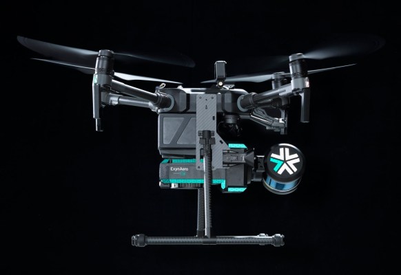
Exyn Technologies announced Tuesday that it has achieved what it considers the highest level of aerial autonomy reached within the industry. The key to the achievement is that Exyn drones are immune to GPS signal loss, meaning all spatial and mapping computations are done onboard, the company said.
Under Exyn’s definitions of autonomy, which are based on a similar standard applied to automotive, the company’s drones have achieved Level 4A autonomy. This means the drones are able to explore a designated 3D area without a remote operator in the backseat, according to Exyn.
Exyn’s achievement is a major step up from the previous level 3 of autonomy, in which a human is required to be present to potentially take over, something that has prevented drones from entering spaces without ranging signals.
The Level 3 aerial autonomy landscape is also defined by point-to-point navigation, in which an operator lays out a sequence of locations for a robot to visit, and the robot does its best to get there. Autonomous aviation startup Xwing’s self-flying utility aircraft will operate on this level by following specific flight paths. However, in real-life use cases, an operator might not have intimate knowledge of the operating environment, and the robot might not be able to access existing maps to learn from and inform its movements.
“We developed an autonomous system that can take you into dark, dirty, dangerous environments,” Exyn’s CTO Jason Derenick told TechCrunch. “Place it at the edge of danger and send it off to collect the information that you need. Oftentimes the information you need is beyond the line of sight, both in terms of communications as well as visual.”
Exyn’s drones are given a capability the company calls “scoutaunomy,” which involves defining a “bounding box volume” around which the drone can fly. Using lidar sensors, the drone can identify volume between explored and unexplored spaces in order to self-navigate and create an accurate, high-resolution map of the space. The drones, which are hardware-agnostic, can also carry additional sensors that collect further information to be integrated onto the maps.
“Think of building a three-dimensional map and then draping on top of it RGB information from the camera, so now you’ve got a photorealistic 3D representation of the space,” Nader Elm, CEO of Exyn Technologies, told TechCrunch. “If we’re carrying heat and humidity sensors, getting radiological reading, getting gas readings, checking the ventilation, et cetera. That’s going to be a very rich dataset that currently underground mining doesn’t have.”
Most of Exyn Technologies’ use cases are in the mining industry, with clients like Rupert Resources and Dundee Precious Metals, where the ability to chart the unknown can keep miners safe and inform better business decisions. The company recently announced a partnership with Swedish mining and construction giant Sandvik that will involve integrating Exyn’s mapping software with Sandvik’s mapping analytics capabilities.
Exyn is also working with government customers for intelligence, surveillance and reconnaissance missions, as well as in nuclear energy, construction and logistics, according to the company.


